There are many good walks in the Mendips, but popular sites on top of the plateau can get a little crowded at peak times. I prefer a walk that starts from one of the spring line villages that surround the upland – more challenging, but a more varied terrain, and a walk where the landscape below is progressively revealed as you rise. A favourite starts from Westbury Sub Mendip, mid-way between Wells and Cheddar, below the southern scarp.
It is often a good idea to start a circular walk near a shop which can provide provisions for a picnic, and a pub, for refreshments afterwards. Westbury has both; and, in addition, the community shop sells guides to local walks prepared by a former resident, Nick Mayor, and friends. I follow a route that leads me uphill through the village and, at a fork in the road, through a farmyard and into fields.
The thin soil and steep slopes make most of the land above the village unsuitable for arable farming, so the walk passes through hay meadows and permanent pasture. It is not intensive farming and is all the more attractive for that, with cowslips and orchids in the spring giving way to the knapweed and bedstraws of late summer. At the higher levels the unimproved calcareous grassland is of national importance as a scarce and specialised habitat.
The walk passes Westbury Quarry, now no longer used for roadstone, but by a company specialising in using explosives for ordnance disposal. Despite the regular bangs the peregrines and ravens still nest and it can be a delight to watch performing aerobatics. The quarry is also famous for a large cave discovered when blasting the rock face broke through the side. The cave had been sealed for 600,000 years and contains one of the most important collections of prehistoric mammal remains in the UK.
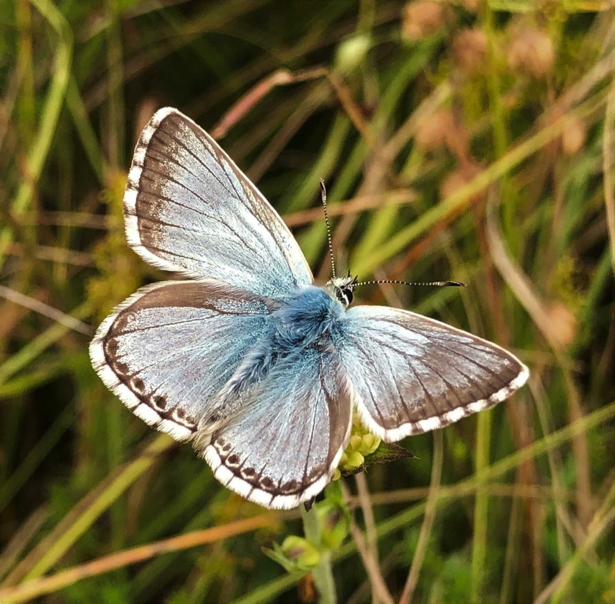
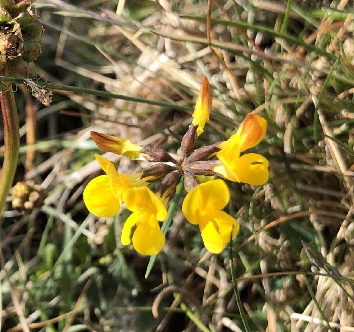
Above and to the west of the quarry the route enters ‘open access’ land leading towards Westbury Beacon. It is a good place to note the difference between the short, rabbit-grazed turf filled with flowers on the protected scarp slope, and the ‘improved’ grass leys on the flatter soils of the plateau immediately to the north. Large stretches of the slope here are managed by Butterfly Conservation as the rich flora supports many common and less common species; in particular horseshoe vetch is critical to the survival of the lovely Chalkhill Blue.
Westbury Beacon itself is a Bronze Age tumulus used in subsequent periods as a site for beacons like those that warned of the Spanish Armada. It offers a splendid view over the Somerset Levels as far as Exmoor to the south and Cardiff across the Bristol Channel. It is also a good point from which to reflect on the turbulent history of England – you can see the distinctive outline of Glastonbury Tor, where the last Abbot was hanged in 1539 for failing to co-operate with Henry VIII, and on a good day the Wellington monument, erected to the victor of Waterloo on the southern edge of the Blackdown Hills. Less easy to spot are Wedmore, where in 878 Alfred the Great signed a peace treaty after defeating Danish invaders, and Westonzoyland, site of the last battle on English soil in 1685, marking the end of the Monmouth rebellion.
Continuing west from the Beacon one passes between the remains of a cold war bunker and an ancient marker stone that indicates the parish boundary – separated by yards on the ground but by centuries of history. The walk continues on access land, though now privately owned. A recent dispute illustrates an anomaly in the legislation on the right to roam: although a landowner is legally required to allow the public to walk anywhere on land designated as ‘open access’, there is no requirement to provide access into it. Fortunately the local dispute is now resolved and it is possible to pass across to another reserve owned by Butterfly Conservation at Stoke Camp.
From the Iron Age earthworks of the camp, the path leads downhill through Stoke Woods, a national nature reserve owned by the Somerset Wildlife Trust, and home to the increasingly rare hazel dormouse. It is classified as ancient woodland though, like much of English woodland, it was clear-felled during the first world war and neglected afterwards. You can see where more recently, volunteers have sought to re-establish a coppice rotation which provides vital habitat for the dormice and many other species.
Dropping out of the wood and through steep pastures once more, one passes through Rodney Stoke and can return to Westbury along the flat land on the edge of the Somerset Levels. It is a different landscape with large oaks instead of the distinctive ash trees of the slopes, and the pastures are more lush, though less varied. It also offers a clear view up to the limestone scarp and the southern edge of the Mendip Hills Area of Outstanding Natural Beauty (AONB), a landscape protected, at least for the time being, by that designation. Let’s hope that proposed changes to the planning system don’t weaken that protection.
Three hours at a moderate pace and time for a pint at the end – the Westbury Inn is highly recommended.