
No, not a Conservative MP addressing his family retainers, but a very useful internet resource.
If you live in the west country, or are planning to visit, Know Your Place is a brilliant website that provides details of all sorts of local historical information. If you are interested in history, or like walking, or simply wish to know more about your surroundings, Know Your place is for you – it covers most of the West Country.
Know Your Place is an online mapping resource that brings together old maps, library and museum collections and linked information. Know Your Place – West of England – covers Bristol, Bath and North East Somerset, Gloucestershire, North Somerset, Somerset, South Gloucestershire, Wiltshire and Devon. Other counties around the UK are interested in a similar mapping service for their areas in the future.
Know Your Place includes heritage data from a variety of sources, including:
- the Historic Environment Record, which consists of information relating to archaeological sites, historic buildings and landscapes, updated and maintained by the relevant local authorities and trusts;
- the Heritage Collections across the region’s libraries, archives and museums; and
- the Apportionment Data which provides supporting information to the historic tithe maps.
There is also a dedicated community layer of information, which is described in more detail below.
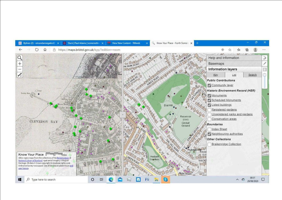
The screen shot shows an area of Clevedon. It shows two generations of maps to allow you to compare the development of the area; the section on the right is the current 2019 Ordnance Survey view and on the left an edition from the late Victorian period. By dragging the map with the cursor, you can immediately contrast the same area in different periods of time, to show how it has evolved. It can show, for example, the appearance – and disappearance – of both railways in the town, with their impact on the street plan. Try to imagine a railway line running through the Triangle, or through North Somerset Council’s offices at Castlewood House! There is a menu on the right which includes both the range of maps which can be called up and the various layers of information that can be superimposed. In this example, monuments, scheduled monuments and listed buildings are shown by the various markers on the map. The green diamond (community layer) on the left, apparently in the sea, is, of course, Clevedon pier and the small dots, representing monuments, are colour coded by their era, from pre-historic to modern.
Different local authorities will list different ranges of maps and local collections, reflecting the resources that are available to them. As a result, there will be a difference in the amount of data that can be shown by different local authorities.
An important aspect of the website is the ability to add material to the community layer. This allows local groups to contribute to the data that is recorded for their community. An active local history group can create and present an increasingly detailed record of the area’s heritage, with notes, photos and links. In the Clevedon map above, two of the links are to walks around the town – “Follow in the Footsteps of Poets” and “a Hike Around Historic Clevedon” – which encourage visitors to explore the heritage for themselves. Other links show historic illustrations of particular locations, enabling a “then and now” contrast. New items which have been added by local groups are moderated by local authority heritage officers, archivists and curators.
The site is an exciting example of what can be achieved by cooperation between local authorities and the public to record their heritage and to make it readily available for residents and visitors alike.